cairngormhills.co.uk
Walking the Big Hills of the Cairngorms"
CORVID-19 is still with us even though most restrictions have been relaxed in Scotland. The risks of infection are lower if outside, there is still a risk if mixing in large groups. Even so, please do not go out in the Cairngorms, or anywhere else, if you are showing signs of Corvid-19 and when out walking make sure you give people space - 1m at least and preferable 2m. Remember that if it feels too crowded then you can walk away and try somewhere else, the hills will still be there tomorrow. Also remember the MRT. They will come out to rescue you but they should not have to put themselves into danger from this virus.
A number of these routes start and finish at the main Cairngorm car park. Currently there is significant building work being undertaken in repairing the funicular. The site is fenced off to keep people out but there are routes across the work for walkers. Please keep out of this dangerous building site and follow the contractor's instructions.
West Drumochter Hills
| A-Mharconaich [NN604764, 975] | |
| Beinn Udlamain [NN579740, 1011] | |
| Sgaineach Mhor [NN599732, 991] | |
| OS map : | 42 |
| start : | A9 Drumochter Summit Layby West |
| gridref : | NN632756 |
| summary : | A9 Drumochter Summit - A'Mharconaich - Beinn Udlamain - Sgaineach Mhor - A9 Drumochter Summit |
| distance : | 16.0km. |
| ascent : | 990m. |
| time taken : | 6hr. 40min. |

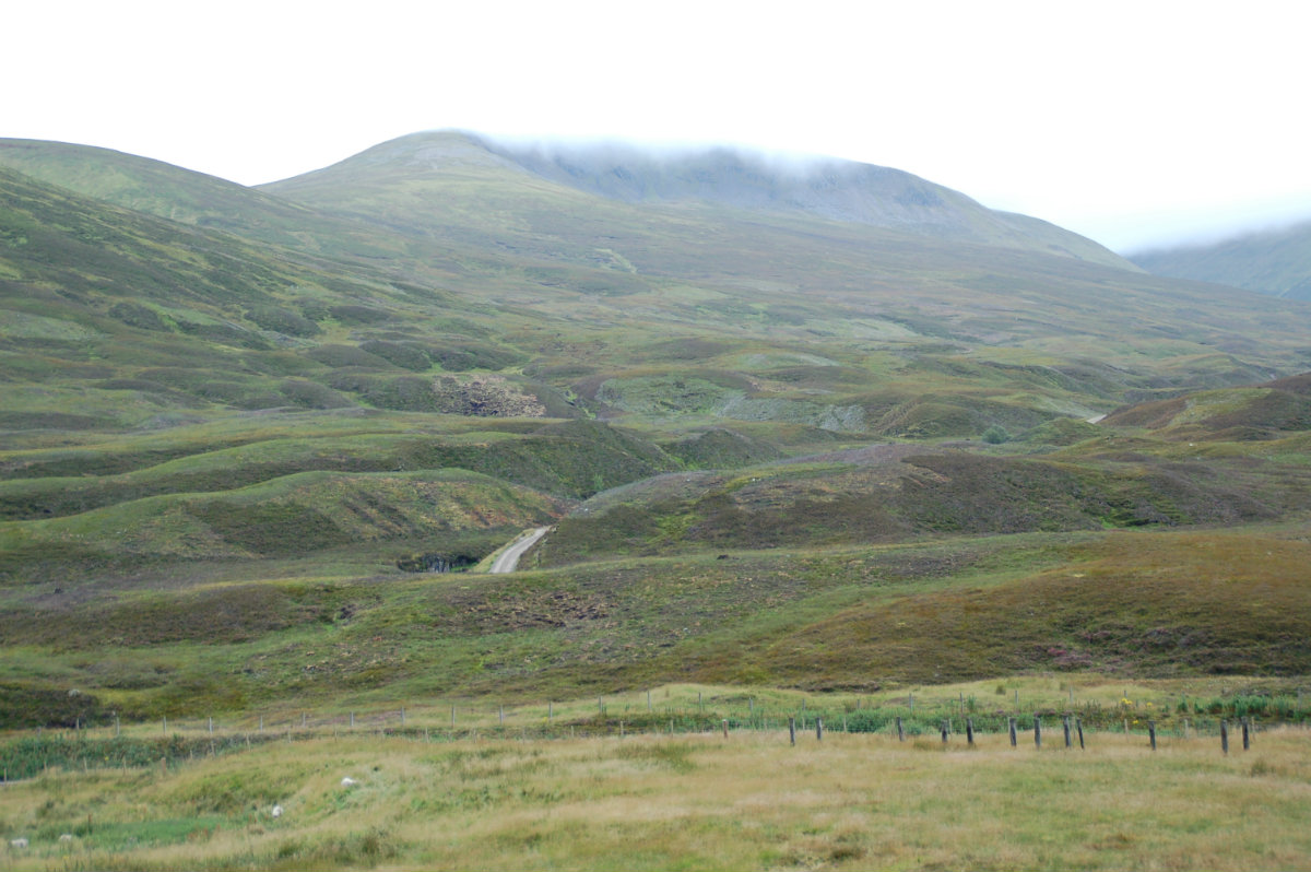
View from the valley
Mist over Sgairneach Mhor
The Drumochter Hills are often seen by the many drivers and passengers racing along the A9 to the promise of greater hills. However the hills to the west of the Drumochter Pass provide an interesting expedition and in the process 3 Munros can be bagged. The hills may not have the sharp ridges and aretes of the west of Scotland nor, the remoteness of the Cairngorm plateau, but they do provide a great day out.
Park in the large layby just North of Drumochter summit on the west side of the road.
The first Munro of the day is to A'Mharconaich. From the layby on the A9 follow the cycle track south the a layby. Then follow the road down to the railway which turns south to reach a tunnel, and then once through the tunnel follow the track back north then west as it climbs Coire Dhomhain. Follow this until a stream is reached. (NN601746). Follow this stream steeply to the summit ridge and then follow the ridge north east to the subsidiary summit, marked with fence posts, and then onto the main summit of A'Mharconaich which is set back from the fence line. Quite confusing in the mist. On the ground are some tussocks and matting - an attempt at re-greening the area.(6.0kms. 530m. 2hrs. 50min.)
The way to Beinn Udlamain is along the connecting ridge. From the summit of A'Mharconaich return back along the ridge SW to meet the boundary fence at the small subsidiary top. Continue to follow the line of the fence over a number of small tops to the main summit of Beinn Udlamain.(3.0kms. 210m. 1hrs. 20min.)
The next summit, Sgairneach Mhor, lies south east of Beinn Udlamain and the walker needs to cross the valley at the bealach. Initially walk south from the summit until the level ground of the bealach is reached. Climb less steeply up the east slopes of Sgairneach Mhor to the summit clearly marked by a Triangulation point set amid a stony flat summit. In mist be careful of the obvious steep ground to North.(3.0kms. 250m. 1hrs. 30min.)
Walk east around the rim of Coire Creagach to the small bealach, NN614737. Descend north to the valley over heather and peat. Cross the Allt Coire Dhomhain (wet feet!) and return by the track to the roadside.(4.0kms. 0m. 1hrs. 10min.)
15th April 2021 A fantastic day of sunshine - still a bite to the gentle breeze - but still a great day. Actually walked up the valley from Balsporran Cottage to the col between Geal-Charn and A'Mharconaich. There is a path up the hillside that meets the ridge then it is left to A'Mharconaich. Such a nice day, I wandered back along the ridge and then onto Beinn Udlamain. Easy walking. Then back to where the path meets the ridge and back down the valley. It makes a difference to do these two hills from the northern rather than southern valley. Some would include Geal-Charn as well but I opted for a walk down the valley.
© cairngormhills.co.uk all rights reserved 2015-2026